04
Apr
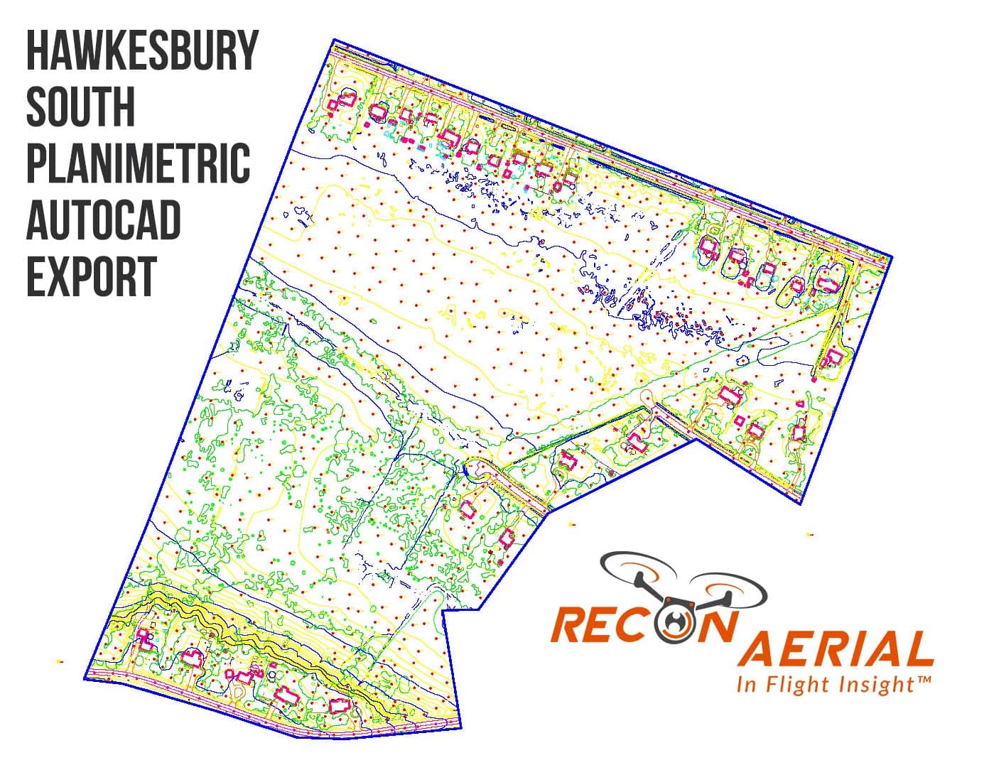
Drone Mapping
Drone mapping leverages cutting-edge technology to provide several key advantages over traditional mapping methods, transforming how spatial data is collected, analyzed, and utilized across various industries. Here are some of the primary technological advantages:
- High-Resolution Imaging: Drones are equipped with advanced cameras and sensors capable of capturing high-resolution images. This allows for the creation of detailed, accurate maps and 3D models, enabling precise analysis and decision-making.
- 3D Modeling and LiDAR: Drones can be equipped with LiDAR sensors (Light Detection and Ranging) to generate detailed 3D models of the terrain, including vegetation, buildings, and other structures. This technology is particularly useful in areas where dense foliage or complex structures make traditional mapping challenging.
- Versatile Data Collection: Beyond visual imagery, drones can carry multispectral and hyperspectral sensors, thermal cameras, and other specialized equipment to collect data across different spectra. This capability is invaluable for applications such as precision agriculture, environmental monitoring, and resource management, where insights into heat patterns, vegetation health, and water distribution are crucial.
- Real-Time Data Processing and Analysis: Some drones and associated software platforms can process data in real time, providing immediate insights that are essential for time-sensitive operations like disaster response, security surveillance, and on-site construction management.
- Autonomous Flight and AI Integration: Modern drones can perform autonomous flights along pre-determined routes, powered by GPS and AI algorithms. This automation ensures consistent data collection and reduces the potential for human error. Additionally, AI and machine learning can analyze the collected data to identify patterns, anomalies, and trends, further enhancing the utility of drone mapping.
- Accessibility and Cost-Effectiveness: Drone technology has become more accessible and cost-effective, democratizing aerial surveying and mapping. Small businesses and local governments can now undertake mapping projects that were previously only feasible for large corporations or federal agencies due to the high cost of manned aircraft surveys.
- Georeferencing and Accuracy: Advanced drones incorporate GNSS (Global Navigation Satellite System) receivers that enable precise georeferencing of the captured images. This ensures that the data collected is accurately mapped to real-world coordinates, enhancing the reliability of the resulting maps and models.
- Reduced Environmental Impact: Compared to traditional surveying methods, drones have a minimal environmental footprint, making them suitable for sensitive ecosystems and areas where conservation is a priority.
- Enhanced Safety: Drone mapping significantly reduces the need for human operators to access dangerous or hard-to-reach areas, improving safety for survey and construction teams.
- Scalability: Drone technology is highly scalable, from small, localized projects to large-scale surveys covering extensive geographical areas. This scalability, combined with the ability to deploy multiple drones simultaneously, makes it an efficient solution for projects of any size.
In summary, the technological advancements in drone mapping offer unparalleled precision, flexibility, and efficiency, making it a transformative tool for a wide range of applications, from urban planning and construction to agriculture, environmental conservation, and beyond.
Need more info? Contact Us!
0 comments