Base Mapping & Drone Survey

Drone Survey - Better Site Planning & Development

Recon Aerial is a drone mapping and surveying company that specializes in commercial drone surveys. We provide base mapping and drone surveys to landowners, engineers, and architects for power and utility planning, land-use planning, environmental surveys, earthworks, mining feature assessment, commercial development, landfill surveys, and more.  

Base Mapping and drone surveys are not meant to compete with or replace land surveys. Drone surveys are powerful planning tools that offer a broader context than traditional surveys since they incorporate a photographic element.  Drones are increasingly being used by our clients to assess existing site conditions before site development but they are also used to create site as-built drawings for industrial and commercial sites.

recon-aerial-dwg-autocad-exports-and-processing
drone survey for civil engineering

Work Smarter, Save Time

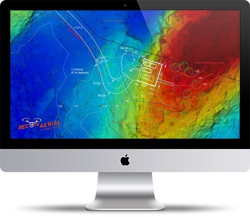
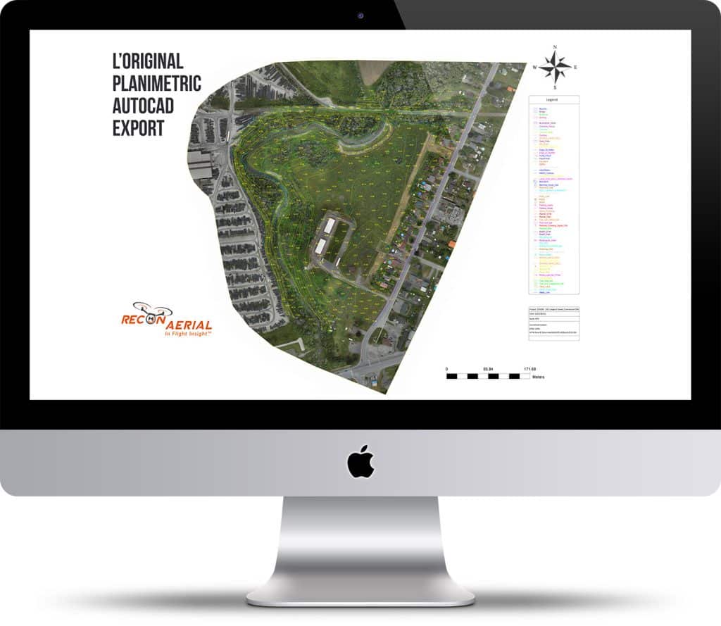
Using a drone for pre-planning we can create extremely useful deliverables that are compatible with AutoCAD and other standard industry software. We can provide a geo-referenced site map, 3D point cloud/model, elevation profile, contours, digital terrain models, 3D mesh, DTM Classified LAS point cloud, Clean Top Tin, and more.

These digital assets allow us and our clients to situate roads, drainage, grading, cut/fill sections, and place site features as AutoCAD layers.  This is possible since the photogrammetric exports from each site provide an incredibly accurate and detailed geo-referenced overview of the site conditions, especially when combined with ground control surveying practices.

Drone surveys enhance the existing planning/development workflow and provide professionals with the opportunity to work smarter, gain a better perspective and deliver a more thorough design in less time!
How does Recon Aerial conduct a drone survey?

Recon Aerial conducts the aerial drone survey (flight operations) in full compliance with the RPAS regulations and in conformance with our internal procedures for safe, efficient drone operations.

Once the drone flight operations are complete, and we have processed the exports we provide the photogrammetric files directly to our clients. If required, Recon creates full functionally, georeferenced AutoCAD exports (.dwg files) specific to the client’s development objectives. The exports we provide are absolutely accurate to less than 5.0cm or less since we highly accurate geodetic L1/L2 survey-grade GPS receivers for ground control.

Drone Surveying - Elevations and Contours

In the example below we created a digital elevation and digital terrain model and brought these models into Auto-Cad for planning/development purposes. This drone survey was undertaken to submit a rezoning application, to provide updated, and accurate documentation to municipal authorities.  At this early stage in planning the client need accurate information but did not want to go through the expense and time of undertaking a complete land survey to submit for the rezoning submission. 

The output for this client is shown here as a before and after comparison. This clearly demonstrates the strength of the drone survey as a tool for site development. We have included property lines, high water setbacks, and elevations on the geo-referenced orthomosaic and digital terrain model. Moving forward it is possible to add additional site features such as buildings, docks, roads, grading, earthworks, drainage, septic systems, power corridors, etc using our baseline map and AutoCAD drawings.