
...

Get in Touch!

We would love to hear about your project. It's easier than you think and you will be impressed with the results!

Contact Info

  • Ottawa, Headquarters
  • info@reconaerialmedia.com
  • Week Days: 09.00 to 17.00

Ottawa Drone Services | Trusted Ottawa Drone Company

Recon Aerial > Ottawa Drone Services | Trusted Ottawa Drone Company
Ottawa Drone Company

Ottawa Drone Services Company

High Quality Aerial Services, Just Say Go!

Looking for a dependable Ottawa drone services company that delivers high-quality results without the stress or sky-high prices?

Recon Aerial is an Ottawa-based drone services company working with commercial and industrial clients across the city and the National Capital Region.

We’ve flown everywhere from remote job sites to the heart of downtown Ottawa, including twilight aerials of 160 Elgin Street, Lansdowne and the Carleton University campus, and commercial property work for clients such as Colliers. Much of Ottawa sits in controlled airspace around Ottawa International Airport, so we handle every NAV CANADA approval before we fly.

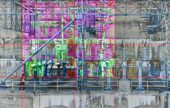
Clients across Ottawa use our work for much more than marketing. Property managers and engineering firms rely on our facade and thermal roof inspections to find problems before they become expensive repairs. Developers and contractors use our construction progress imagery to keep stakeholders up to date, and our drone mapping delivers survey-grade, AutoCAD-ready linework that engineering teams can open and use right away.

Because we’re based in Ottawa and have been flying here since 2015, we know the local rules as well as the airspace. Beyond Ottawa International, we plan around Rockcliffe and Gatineau airports, and we obtain National Capital Commission permission for flights involving NCC lands. That local experience means fewer delays, and in most cases we can be on site within days, on both the Ontario and Quebec sides of the river.

Our Transport Canada-certified Advanced pilots show up on time, fly safely and legally, and deliver fast, with clear pricing and no surprises. Whether you’re in downtown Ottawa, Kanata, Orléans, Nepean or Barrhaven, we’ll bring the same attention to detail to your project.

Ready to get started? Tell us about your project, and we’ll send you a fixed quote the same day.

Brian Stoneman, President of Recon Aerial

Brian M. Stoneman

President, Recon Aerial
Golden Parliament Hill Panorama ottawa drone services

10

+
Years Of Experience

10

+
Years of experience
Golden Parliament Hill Panorama ottawa drone services

Recon Aerial delivers expert drone imaging, inspections, mapping, and construction support with precision, reliability, and value—making us the smart, trusted choice for your needs.

Want to Know More? A Few Drone Services


Our Ottawa drone services include:

Ottawa Projects

Recent Drone Projects in Ottawa and the Capital Region

Here are four recent drone projects across Ottawa and the National Capital Region, with the real scope, results and deliverables for each. Every project is planned around the site’s airspace, access and safety requirements, including NAV CANADA approvals for sites inside Ottawa International Airport’s controlled airspace and National Capital Commission permission where needed.

university of ottawa image capture for promotional project
Aerial Video for the University of Ottawa, Ottawa Hospital Campuses
The University of Ottawa needed aerial footage for a video aimed at attracting new medical students. We captured high-resolution raw video over Ottawa’s hospitals and health care facilities, giving the production team flexible footage to edit into the final highlight video.
  • High-resolution raw video for post-production
  • Aerial coverage of Ottawa hospitals and health care facilities
  • Footage supporting the university’s medical student recruitment
construction drone media capture for reliance construction at 70 nicholas ottawa
Construction Media for Reliance, 70 Nicholas Street
Reliance Construction needed imagery to document its project at 70 Nicholas Street in downtown Ottawa. We captured high-resolution photos and video that supported both construction progress tracking and project highlight media.
  • High-resolution construction progress photos
  • Aerial video for project highlight media
  • Downtown Ottawa site, flown in controlled airspace
mapping project ottawa ontario for slr consulting lac des fees
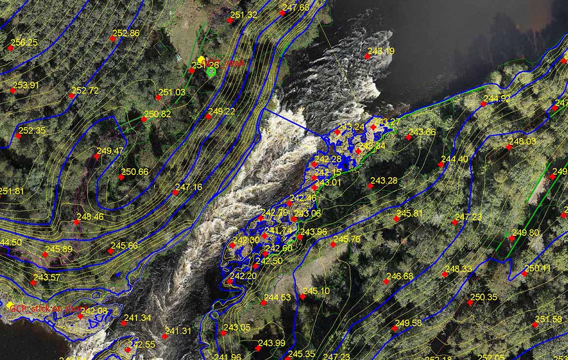
Survey-Grade Drone Mapping, Lac des Fées, Gatineau
georeferenced mapping backed by ground control points, along with layered AutoCAD planimetric drawings ready for their team to use.
  • Georeferenced imagery backed by ground control points, with raw GCP and accuracy data
  • Layered DWG planimetric drawings, with and without orthomosaic backing, plus PDF drawings
  • Orthomosaic, 3D mesh, point cloud, classified LAS, DSM, DTM and contours
    Clean Top TIN
commercial real estate drone shot for trinity at citigate ottawa
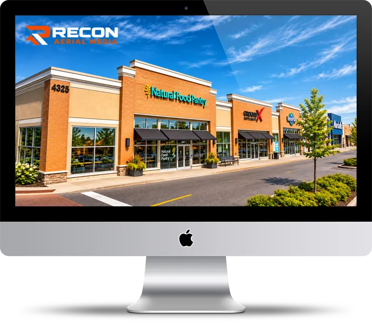
Commercial Real Estate Photography for Trinity, City Gate
Trinity uses our aerial photography to promote its commercial properties across Ottawa, including the City Gate plaza. We capture each property and its surroundings from the air, producing imagery for listings, marketing materials and promotional media.
  • Aerial photography of commercial plazas across Ottawa
  • Imagery for promotional and marketing media
  • Property context: access, surroundings and nearby amenities
Quality Results

What We do For You?

High Quality Aerial Services, Just Say Go!

At Recon Aerial, we are your trusted drone service company in Ottawa, dedicated to capturing exceptional drone media for a wide range of projects across Ottawa, Ontario. Whether you need stunning aerial photography or smooth, cinematic drone video, we deliver fast, reliable, and professional results every time.

Our mission is to help you see your project from a whole new perspective. We specialize in aerial imaging solutions for commercial, industrial, and creative projects alike. From real estate showcases and property development videos to promotional campaigns, internal pitch decks, and project development briefs — we create high-impact visuals that get noticed.

Speed is one of our biggest advantages. Most of our drone flight operations are completed within a week, and we often deliver final drone photos or videos as fast as the very next day via secure data transfer or courier.

Our aerial photos are shot in RAW format at 16:9, 4:3, or 3:2 ratios to give you maximum flexibility in editing. For video, we typically capture crisp 4K footage at 24 to 60 frames per second, ensuring your visuals are sharp, smooth, and professional.

Clients across Ottawa trust Recon Aerial because we make drone media easy and hassle-free. Whether your content is destined for websites, social media, brochures, presentations, or confidential reports, we provide the aerial footage and data you need to elevate your project.

If you’re looking for a reliable, responsive drone service company in Ottawa, look no further. Reach out today, and let’s get your project off the ground! 

Construction Site Video Monitoring
Value for Money

Why Choose Recon Aerial as your Ottawa Drone Company

High Quality Aerial Services, Just Say Go!

If you’re looking for an Ottawa drone company that delivers real value, look no further than Recon Aerial. When you work with us, you’re not just hiring someone with a drone — you’re partnering with a trusted, experienced team that guarantees professional, legal, and high-quality results every time.

We use Transport Canada-certified Advanced Pilots for all operations and proudly hold Flight Reviewer status, meaning we don’t just fly drones — we’re qualified to test and certify new pilots across Canada. That’s the level of expertise we bring to your project.

With full liability insurance and flight experience ranging from remote rural sites to the heart of downtown Toronto, we’ve covered everything from tight airspace to wide-open landscapes. We’ve worked with major names like Trinity, Manulife-Colliers, Circle K, Pomerleau, Riocan, Ontario Power Generation, SNC-Lavelin, SGS and many more — because they trust us to get the job done right.

From construction and real estate to film, mapping, and energy, we’ve provided drone photos, video, and data for 500+ clients across all sectors. With 10+ years in the business and thousands of successful flights under our belt, we know how to get the shot — and we know how to deliver on time, every time.

At Recon Aerial, we combine experience, efficiency, and affordability to give you the best value for your investment.

Choose a proven Ottawa drone company that delivers more for less.
Let’s fly smarter — Contact Recon Aerial today to get started!

construction timelapse services
Value for Money

Drone Services in Ottawa: Frequently Asked Questions

Yes, but commercial drone work in Ottawa must follow Transport Canada rules. Pilots need the right certificate for the type of operation, and flights near people, in controlled airspace or over certain properties need extra approvals. Our Transport Canada Advanced Pilots handle all of this for you.

Yes. Much of Ottawa sits inside controlled airspace around Ottawa International Airport, and downtown has additional restrictions around federal sites. We obtain the required NAV CANADA authorizations before every flight. Most approvals come through quickly, but sites right next to the airport can take an extra day.

You need the property owner's permission to take off and land, and some land, such as National Capital Commission property, has its own rules. We confirm site access and permissions as part of planning, so you don't have to.

We fly throughout Ottawa and the National Capital Region, including downtown, Kanata, Orléans, Nepean, Barrhaven, Stittsville, Manotick and Gatineau.

Most Ottawa drone flights are completed within a week of booking, and photos and video are often delivered as soon as the next day.

Yes. All our pilots are Transport Canada-certified Advanced Pilots, and we carry full commercial liability insurance. We also hold Flight Reviewer status, which means we're qualified to test and certify other drone pilots.

We provide drone photography and videography, drone inspections, drone mapping and surveying, and construction site drone services, including construction progress photography.

drone videography services

Our drone services offer exceptional value for money, combining professional quality with competitive pricing. You get high-impact results without overspending. From stunning visuals to efficient data capture, every dollar works harder for your project. We help you stay on budget while achieving impressive outcomes that elevate your brand or operations.

Our services

Principal Drone Services

Aerial drone photo of the Toronto skyline
Media Capture and Production
If you can think of it, we've shot it! Movies, TV shows, documentaries, commercials, commercial real estate, backplating, 3D modelling, project briefs, pitch decks, websites, social media and post-production project videos. We love to get creative, so challenge us and see what we can do!
Drone inspection of critical infrastructure
Drone Inspections
We've inspected many types of critical infrastructure, including wind turbines, power lines and electrical infrastructure, building facades, bridges, cell towers, dams, railways, roofs, flare stacks and solar panels. We provide high-resolution imaging, often backed by AI, to detect damage or inefficiencies.
Drone mapping and surveying deliverable
Mapping and Surveying
We use the best drones and survey receivers to create highly accurate maps, and we offer a first-in-Canada Aerial-to-AutoCAD workflow. We deliver survey-grade mapping images with georeferenced linework directly to our clients' desktops. Because the linework is layered on georeferenced images of your site, it's more useful than traditional survey drawings. Just open the files and get to work!
Drone services for construction sites
Construction Sites
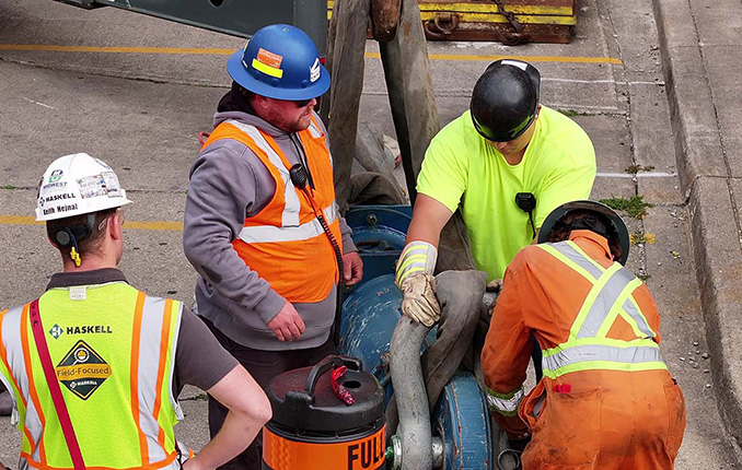
We offer construction progress photography, site management media, live-stream timelapse services and CAD mapping. We help site staff and project managers see their site from a different perspective, which cuts down evaluation time, helps predict problems before they occur and keeps projects on schedule. Project managers can quickly confirm work completion.
Our Work

Getting it Done!

Drone services image over river 2
10
+

Years Strong

475
+

Happy Clients
Drone services image over river 3 (1)
1500
+

Missions Flown

500000
+

Kilometers Travelled