


Get in Touch!

We would love to hear about your project. It's easier than you think and you will be impressed with the results!

Contact Info

  • Ottawa, Headquarters
  • info@reconaerialmedia.com
  • Week Days: 09.00 to 17.00

Commercial Real Estate Drone Photography

Recon Aerial > Commercial Real Estate Drone Photography
Commercial Real Estate

Commercial Real Estate Drone Photography

Aerial photos and video for brokers, landlords and developers

Help your property stand out before anyone sets foot on site.

Commercial buyers and tenants judge a property by its location, access, size and surroundings, and nothing shows that faster than an aerial view. Our commercial real estate drone photography and video give your listing, leasing package or investment brochure the context ground photos can’t.

We work with brokerages, property managers, landlords and developers across Ontario and Quebec, capturing office buildings, industrial sites, retail centres, hotels and development land.

  • Shows the whole site: buildings, parking, loading and land in one image
  • Highlights location: highways, transit and nearby amenities
  • Attracts serious interest: tenants and investors see value faster
  • Ready for every format: brochures, listings, websites and presentations
Brian Stoneman, President of Recon Aerial

Brian M. Stoneman

President, Recon Aerial

Colliers International Commercial Real Estate Video

Carp Road, Ottawa: aerial photography and video for Colliers International, showing the building, site access and surrounding area.

Our Commercial Real Estate Services

Aerial Property Photography and Video for Every Listing

Whether you need a set of aerial photos for a leasing brochure or a full video for an investment package, we have an option that fits your property and budget.

Drone Photography

Starting $399.99
  • High-Resolution Aerial Photos
  • Site, Access and Context Shots
  • Building and Neighbourhood View
  • Edited and Ready to Use
  • Fast Turnaround! 

Drone Video

Starting $695 + flight
  • Cinematic Real Estate Drone Footage
  • Edited 1, 2 or 3-Minute Videos
  • Logo, Music and Text Overlays
  • Google Earth Location Drill-Down
  • Perfect for Investor Packages!

Photo and Video Package

Custom Quote
  • Photos and Video in One Flight
  • Ground and Interior Add-Ons
  • Multi-Property Portfolios
  • Consistent Look Across Assets
  • Best Value!
Interior and Product Photography

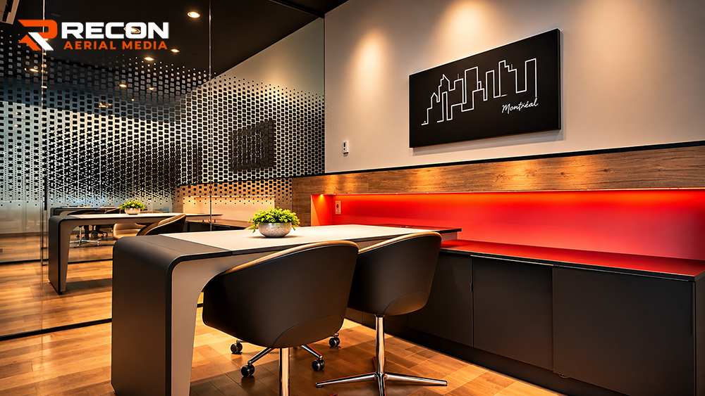
Commercial Interior Photography With a Premium Finish

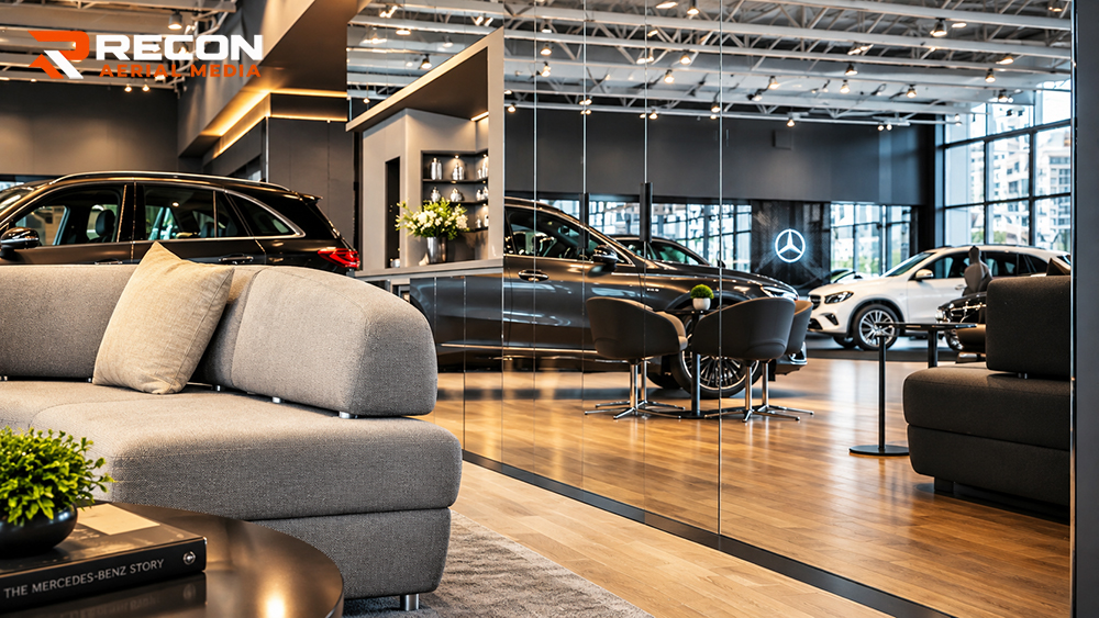
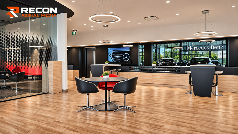
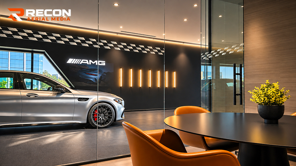
Great interior photography takes more than a good camera. It takes careful control of light, reflections and composition to capture a space, and everything in it, the way a brand wants to be seen. We use every traditional photography tool at our disposal, then apply AI-assisted editing to add the finishing touches that make an image truly special.

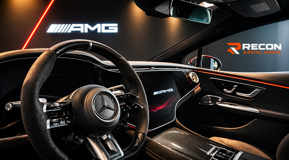
Our work for a Mercedes-Benz dealership shows that attention to detail, from the showroom and client lounges to the vehicles themselves, down to the stitching on the steering wheel and the red of the brake calipers.

Our AI-enhanced workflow lets us balance mixed lighting, clean up distracting reflections and refine colour and detail faster and more precisely than traditional editing alone. Every enhancement is guided by a photographer’s eye, so the final image stays true to the real space while looking its absolute best. It’s how we deliver magazine-quality results on commercial timelines and budgets.

Every image is professionally shot, edited and enhanced, giving businesses visuals that match the quality of what they sell. 

Exterior and Aerial Photography

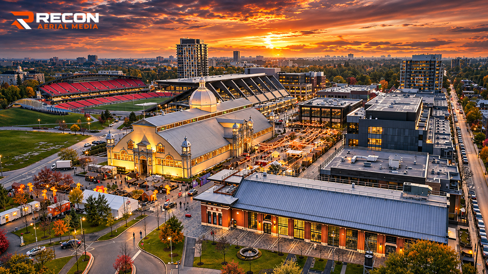
Aerial Real Estate Photography That Shows the Whole Picture

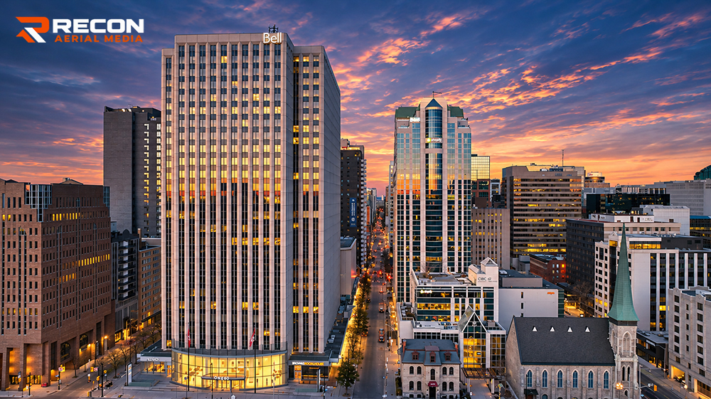
The right light and the right angle can transform how a building is seen. We plan every shoot around timing and composition, from crisp daytime facades to dramatic twilight aerials, when office lights glow against a sunset sky. Our images of 160 Elgin Street in downtown Ottawa show what that planning delivers: the tower, its neighbourhood and the city around it, captured in a single frame.

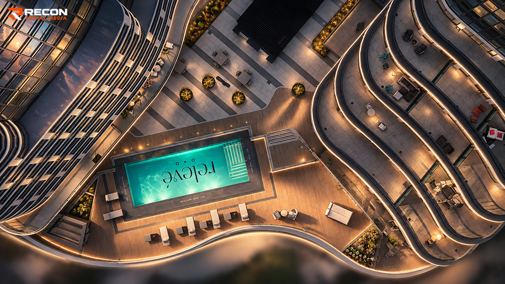
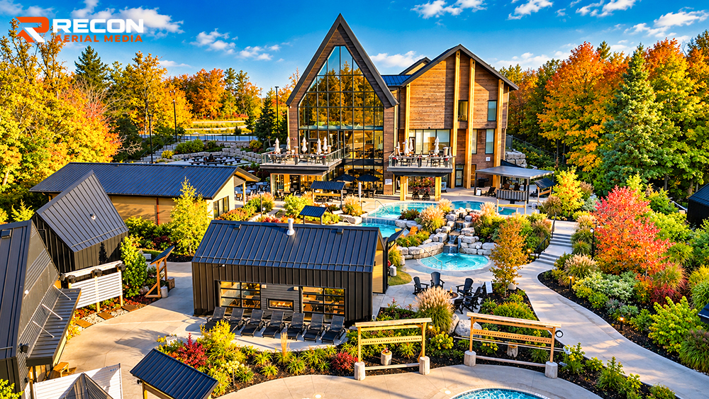
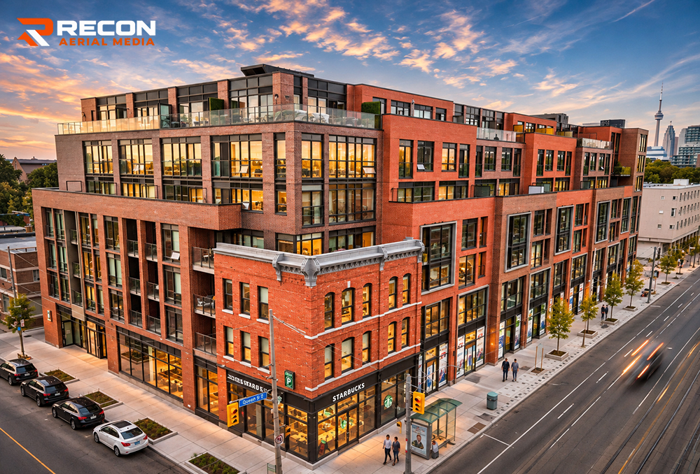
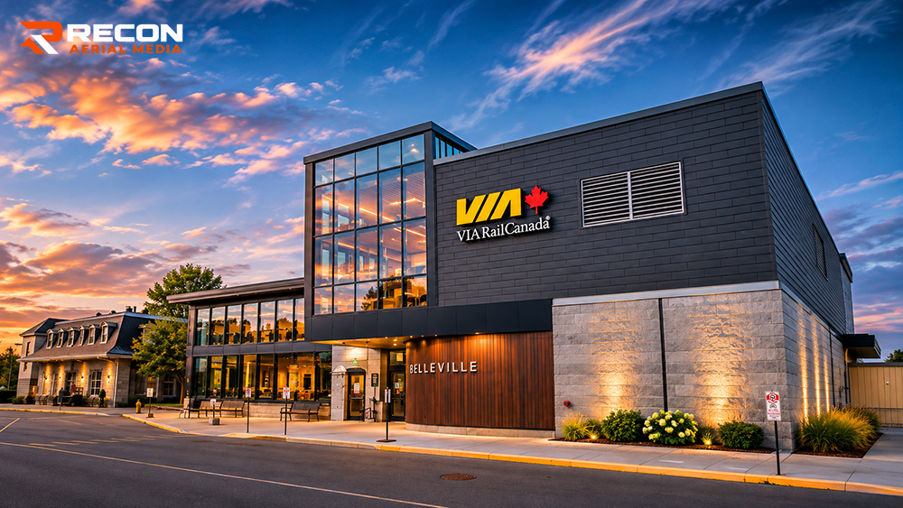
From downtown Ottawa to Toronto, Belleville and cottage country, we combine drone property photography with ground-level exterior shots of entrances, facades, signage and rooftop amenities, then edit every image to a premium finish. The result is a complete set of commercial real estate visuals for leasing brochures, sales listings, investor presentations and brand marketing.

Interior Photography

Mercedes Benz

Exterior Photography

Portfolio Quality Exteriors

What You Get

Commercial Real Estate Photography, Delivered Ready to Use

High-resolution images built for marketing, leasing and investment

Every commercial real estate drone photography shoot starts with a quick planning call about the property, its selling points and how the images will be used. We plan the flight around the best light, handle all airspace approvals, and capture both aerial and ground-level views of the site.

You receive professionally edited, high-resolution images in the formats you need, ready to drop into brochures, listings, websites and presentations. Video, interior photography and twilight shoots can be added to the same visit.

Need it fast? Most edited photos are delivered within days of the shoot.

Our Clients

Who Hires Us?

Projects

How Our Clients Use Their Images

drone videography services

Our aerial property photography works hard across every stage of a commercial deal:

  • Leasing brochures and availability flyers
  • Sales listings and offering memorandums
  • Investor presentations and annual reports
  • Property and company websites
  • Social media and digital ads
  • Development approvals and community updates
  • Signage, hoarding and print marketing
  • Before-and-after records of renovations


RECON Aerial Media FAQ iPhone Mockup
Questions

Commercial Real Estate Drone Photography FAQ

Aerial photos show what ground photos can’t: the full site, parking, loading access, nearby highways and amenities, and how the property fits into its neighbourhood. Tenants and investors understand a property’s value faster, which helps it stand out in brochures and listings.

Yes. We regularly combine aerial photography, ground-level exterior shots and interior photography in one visit, giving you a complete, consistent set of images while saving time and cost.

Yes. Commercial real estate drone video is one of our core services, for office buildings, industrial sites, retail centres, hotels and development land.

Yes. Many commercial properties sit in controlled airspace. We obtain the required NAV CANADA authorizations before every flight, and sites close to an airport may need a little extra lead time.

Yes. Twilight aerials, when building lights glow against the evening sky, are among our most requested commercial real estate images. We schedule these shoots around sunset and the weather for the best results.

Most edited photos are delivered within days of the shoot. Rush delivery is available for tight listing or presentation deadlines.

Yes. Our pilots are Transport Canada-certified Advanced Pilots, and we carry $5 million in aviation and general liability insurance.

Ready to Start?

Let’s Showcase Your Property

Tell us about your property and how you’ll use the images, and we’ll recommend the right mix of aerial, exterior and interior photography and video, with a quote the same day. Need video too? Our drone videography services can often be captured on the same flight.

Let's Get Started!

Our services

Principal Drone Services

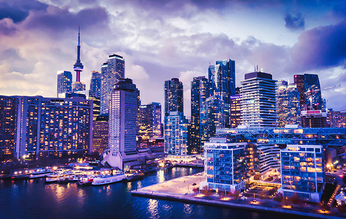
Aerial drone photo of the Toronto skyline
Media Capture and Production
If you can think of it, we've shot it! Movies, TV shows, documentaries, commercials, commercial real estate, backplating, 3D modelling, project briefs, pitch decks, websites, social media and post-production project videos. We love to get creative, so challenge us and see what we can do!
Drone inspection of critical infrastructure
Drone Inspections
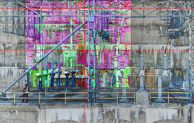
We've inspected many types of critical infrastructure, including wind turbines, power lines and electrical infrastructure, building facades, bridges, cell towers, dams, railways, roofs, flare stacks and solar panels. We provide high-resolution imaging, often backed by AI, to detect damage or inefficiencies.
Drone mapping and surveying deliverable
Mapping and Surveying
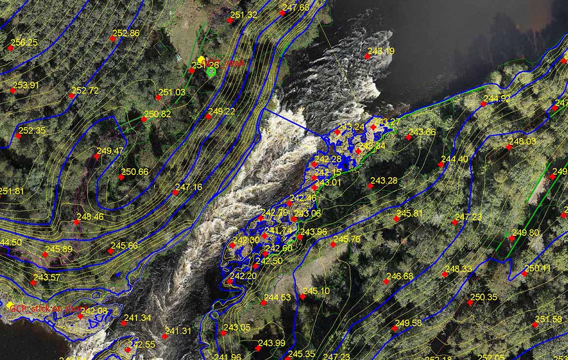
We use the best drones and survey receivers to create highly accurate maps, and we offer a first-in-Canada Aerial-to-AutoCAD workflow. We deliver survey-grade mapping images with georeferenced linework directly to our clients' desktops. Because the linework is layered on georeferenced images of your site, it's more useful than traditional survey drawings. Just open the files and get to work!
Drone services for construction sites
Construction Sites
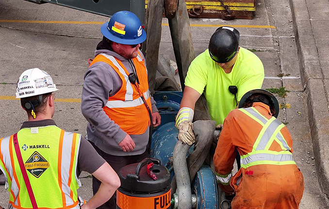
We offer construction progress photography, site management media, live-stream timelapse services and CAD mapping. We help site staff and project managers see their site from a different perspective, which cuts down evaluation time, helps predict problems before they occur and keeps projects on schedule. Project managers can quickly confirm work completion.
Our Work

We Get Around!

about recon aerial drone services
10
+

Years Strong

about recon aerial drone services
475
+

Happy Clients

about recon aerial drone services
1500
+

Missions Flown

about recon aerial drone services
500000
+

Kilometers Travelled